Loading...
An ISO 9001:2015; 45001:2018 Certified Company & NABL Accredited lab as per ISO/IEC 17025:2017

Onland Geotechnical & Geophysical Survey

Onland Integrated Survey Solutions

Many significant constructions are built on strong foundations on suitable soil and underlying material beneath the site. This is precisely where we step in as a pioneer in offering geotechnical surveys. Our services, combined with sophisticated geotechnical equipment, can help the building owners assess whether or not a site is suitable for the proposed construction at the given time. Whether you are planning to build a commercial project in a highly urbanized area or an area with challenging environmental conditions, we at SGES can provide end-to-end Geotechnical surveys. With our solutions, we can now determine whether or not a site is suitable for the proposed construction at the given time in its current state.

Onland and Near-shore Geotechnical Investigation

We are a leading service provider in the Geotechnical engineering space for on-land and near-shore projects for Residential Commercial Buildings, Dams, Thermal,Wind & Hydro Power Projects, Coastal works, Ports and Jetties etc.

  • Mechanically/hydraulically operated rotary/wireline drilling rigs Single, Double and Triple Tube Core Barrels
  • Standard Penetration Test
  • In-situ Pressure meter Test
  • Insitu Vane Test
  • Field Permeability Test
  • Compaction Control Tests
  • Field CBR Test
  • Design and Installation of Multiple Well-point System for Dewatering
  • Piezometer to Monitor Pore water Pressure
  • SPT energy measurement
  • Block Vibration Test
  • Packer test
  • Axial, Lateral and Pull-out Test of Piles
  • Plate load test
  • Cone penetration test (SCPT, DCPT)
  • Pull-out Tests on Grouted and Driven Nails

Foundation Design

  • We provide tailored recommendations for foundation types, whether shallow, deep, or specialized, based on site-specific geotechnical properties.
  • Design parameters for foundations, including bearing capacity, settlement predictions, and stability under loads
  • Load settlement assessment of foundation using advanced softwares like Plaxis 3D.

Avoid Any Surprises of Risk During or After the Construction with our Geotechnical Investigations

SGES has acquired unremarkable geotechnical survey capabilities that can cater to the determination of specific engineering properties of the soil and rock beneath a site and ground response to the expected natural calamities like seismic shaking.

Our extensive geotechnical and geophysical surveys empowered us to stay ahead of the thriving competition while ensuring that we address all the problems encountered in the evolving construction landscape.

Below is a comprehensive list of our geotechnical and geophysical survey capabilities.


  • We own the first ever purpose-built combination SPT, CPT and Wireline Rotary Core Test Drill Rig TMG CSR-183 manufactured by TMG.
  • In-depth knowledge of soil conditions, construction practices, and supplier networks spread across the globe.
  • Experience in handling soils of any type in any terrain with unparalleled drilling experiences
  • Certified testing laboratories equipped with advanced geotechnical equipment
  • Trained engineers and geotechnical experts with hand on experience in exhibiting optimum geotechnical survey experience in demanding field conditions
geotechnical and geophysical surveys SGES

Pressuremeter test for soils and rocks – ASTM D4719-20, IS 1892: 2021

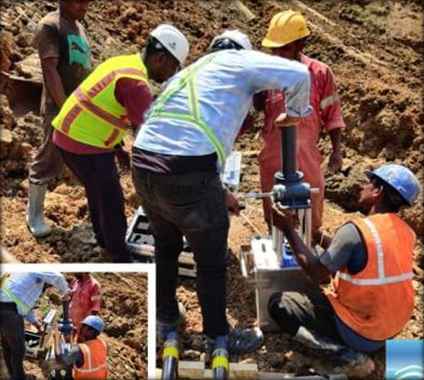
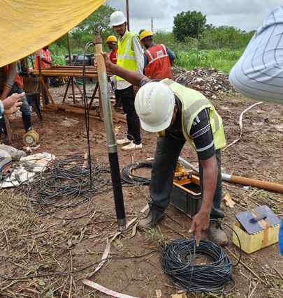
The Pressuremeter Test, a widely recognized geotechnical in-situ investigation method which serves as a pivotal tool for evaluating the mechanical properties of soils and rocks. The importance of the Pressuremeter Test lies in its ability to address the unique challenges posed by the region's geology and soil diversity.

Generally, the Pressuremeter Test involves the insertion of a cylindrical probe into the ground, which is then pressurized incrementally. This process allows engineers to measure the resulting radial expansion of the borehole wall, providing valuable data on soil or rock stiffness, strength, and deformation characteristics.

Moreover, the Pressuremeter Test plays a crucial role in mitigating risks associated with construction in regions prone to seismic activity. By providing precise data on soil and rock behaviour under stress conditions, engineers can design structures that withstand seismic forces more effectively, ensuring the safety and longevity of infrastructure projects.

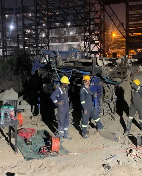
Pressuremeter Test SGES
 geotechnical investigation

Furthermore, in urban areas experiencing rapid development and population growth, the Pressuremeter Test aids in site characterization and foundation design for high-rise buildings, bridges, and other critical infrastructure. Its ability to provide reliable data on soil and rock properties not only enhances the safety and performance of infrastructure projects but also contributes to sustainable development and resilience in the face of geological challenges and environmental hazards.

SGES Experience/Credentials:

Sarathy Geotech and Engineering Services has the in-house expertise to conduct Pressuremeter Tests (PMT) for rocks (up to 200 Bar) and soils (up to 100 Bar). Over the past decade, we have successfully completed nearly 500 projects, including metro rails, high-rise buildings, refineries, power plants, and tunnels, ensuring customer satisfaction across India.

Geophysical Survey

Multichannel Analysis of Surface Waves – IS 1892: 2021, and IRC:123 – 2017.

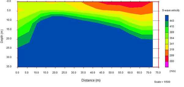
Multi-Channel Analysis of Surface Waves (MASW) is a non-invasive geophysical method which uses Rayleigh-type surface waves to estimate the shear-wave velocity (Vs) of soil or similar materials. Vs is an indicator of stiffness and hence this method is used for subsurface characterization. MASW is applied to solve a wide range of geotechnical and geophysical problems. It generally is used for near-surface geotechnical characterization of materials, seismic characterization of pavements, seismic investigation of sea bottom, mapping bedrock surface, and, most importantly, to generate shear-wave velocity profiles. Recently, MASW also has been used for compaction evaluation, grouting evaluation, and target detection of voids, weak zones, and so forth. Because MASW is a non-invasive type of seismic survey, it is extremely popular among professionals due to its speed of execution, and it is very economical compared with other seismic survey methods.

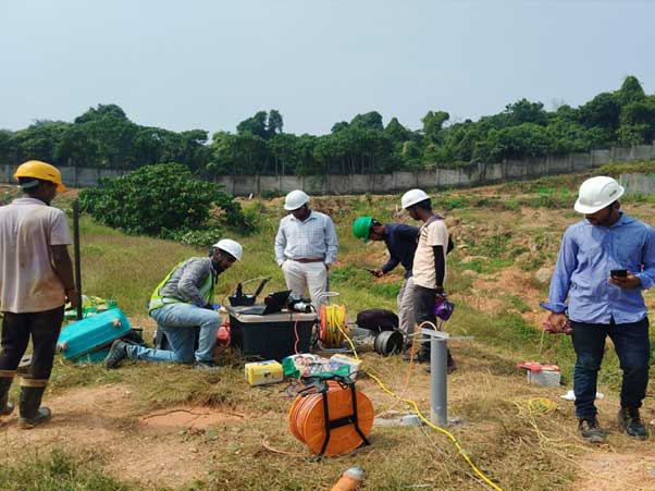
Geophysical Survey Sarathy Geotech

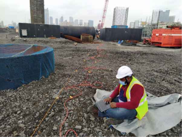
The standard procedure for MASW involves three significant steps: acquisition of experimental data in the field, processing of acquired signals to obtain experimental dispersion curves (phase velocity versus frequency), and an inversion process to estimate site properties. The acquisition process involves generation and collection of surface-wave data from the ground. MASW data processing involves the extraction of accurate dispersion curves from the acquired surface-wave data. The final step consists of the inversion process, which includes obtaining a one-dimensional 1-D Vs profile by inverting the surface-wave dispersion data. These 1D Vs profiles are then extrapolated and integrated to get 2-D Vs profiles.

SGES Experience/Credentials:

SGES has successfully completed numerous projects where Multichannel Analysis of Surface Waves (MASW) played a key role in geophysical investigations. Notable projects over the past decade include the Mumbai coastal road projects, various metro projects in the country, thermal and nuclear power plants, refineries, and real estate developments etc. In each case, SGES delivered MASW services to the highest level of customer satisfaction.

Seismic Refraction Test – ASTM 5777-18, IS 15681-2006, IS 1892: 2021, and IRC:123 – 2017.

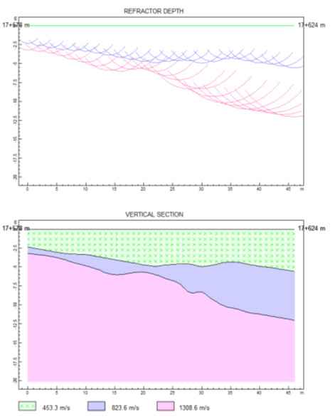
The seismic refraction test is a widely used geophysical method for subsurface exploration that helps determine the depth and characteristics of geological layers. This technique is particularly effective in identifying bedrock. It relies on the principles of seismic wave propagation and refraction, making it a valuable tool in geotechnical engineering, environmental studies, and geological mapping. Seismic refraction is based on the behavior of seismic waves as they travel through different geological materials. When a seismic wave encounters a boundary between two materials with differing densities and elastic properties, it refracts or bends. The speed of seismic waves varies depending on the type of material; typically, waves travel faster in denser and more rigid materials (like bedrock) compared to softer materials (like soil or clay).

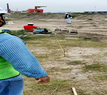
The generalised methodology is same as MASW, where in data acquisition, a series of geophone of 10 Hz natural frequency is laid over the ground in a straight line, spaced at regular intervals. A seismic source such as a sledge hammer, drop hammer or explosive is placed at regular interval within the geophone spread and is used to generate compressional waves (P – waves). These P – waves propagate through various geological layers present at the testing site and get detected by the geophones. These geophones convert the ground motion to electric signals and the arrival times of the waves at each geophone is recorded, thereby creating a dataset that reflects the subsurface structure.

The recorded arrival times are analysed to create a travel-time plot. This plot displays the time it takes for waves to travel from the source to each geophone, allowing for the identification of refracted waves. Using this travel-time data, geophysicists employ mathematical models to interpret the subsurface conditions. By applying the principles of refraction, estimations are made for the depths and seismic velocities of various geological layers.

The seismic refraction test is a valuable tool for subsurface exploration, providing crucial insights into geological formations and material properties. Its non-invasive nature and cost-effectiveness make it an attractive choice for various applications in geotechnical engineering, environmental assessments, and geological mapping.

seismic refraction test

SGES Experience/Credentials:

SGES has successfully completed numerous projects where Seismic Refraction Technique (SRT) played a key role in geophysical investigations. Notable projects over the past decade include the Mumbai coastal road projects, various metro projects in the country, thermal and nuclear power plants, refineries, and real estate developments etc.